Objective
The Himalaya have experienced a large number of disturbances and natural disasters over the past decades. Despite the vulnerability of the region and its cultural and environmental importance, there is a lack of accurate and up-to-date information about urban settlements in the region and those most at risk in this coupled social-environmental system. Our research aims to fill these knowledge gaps.
The two primary goals of our research are to:
1) characterize and quantify land cover and land use change associated with urban settlement change,
and
2) assess the vulnerability of these urban settlements to hazards.
We are using multi-scale and multi-source satellite data applied to the Turner et al. (2003), Luers et al. (2003), and O'Brien et al. (2004) frameworks to answer five land cover and land use change and vulnerability questions about the Himalayan region:
- How and where are urban settlements changing, and what are the associated land use and land cover changes with these changes?
- What are the frequency, magnitude, and duration of the four dominant natural hazards- earthquake, fire, flood, and landslides-and how do they vary over time and space?
- What is the sensitivity of the socio-economic system to different stressors
- Where are urban settlements most vulnerable and to what stressors are they most vulnerable
- What explains differences in the vulnerability of urban settlements across the Himalayan region?
Background
Home to about 210 million people and extending over eight countries, the Himalayan region is at the intersection of two major trends that together are transforming one of the most dynamic mountain systems in the world. First, the region is a hotspot for four natural hazards: earthquakes, fires, floods, and landslides. When these hazards lead to loss of life and significant damage to property, they become natural disasters.
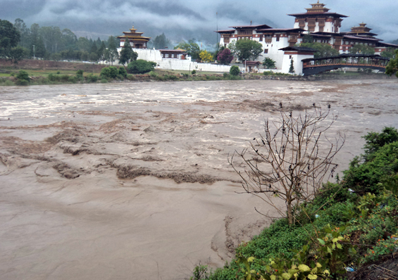
Over the past few years, the Himalayan region has experienced a number of devastating natural disasters, including a 7.5 magnitude Pakistan-Afghanistan earthquake in 2015, a glacial lake outburst flood in northern Bhutan in 2015, floods in Uttarakhand in 2013 that left nearly 6,000 dead and more than 100,000 people trapped by landslides, damaged roads, and flooded conditions, and the 7.8 magnitude earthquake in Nepal in 2015, that killed more than 9,000 people and injured more than 23,000.
The second major trend in the Himalayan region is urbanization. Fueled by migration from rural areas, valleys and plains, the growth of religious, ecological and adventure tourism, and recent social unrest, towns and urban centers are expanding. Although the region is still predominantly agrarian, migration to urban centers is increasingly an important livelihood strategy for rural households, and non-farm income is an increasing component of household incomes (Maharjan et al. 2013).
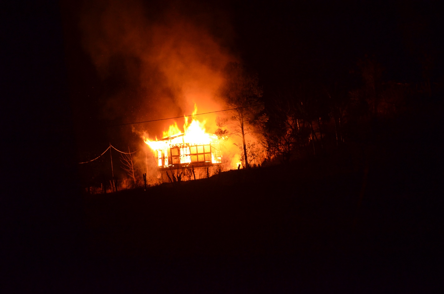
A house destroyed by fire in Punakha, 2016 (Photo credit: Indra Acharja)
As recently as 1981, less than 10% of the Himalayan population lived in a town or city. By 2000, the urban population in the region had doubled to 20% (Zurick 2006). The growing urban population, an urbanizing economy, and associated land use and land cover changes are transforming the Himalayas. Construction of buildings, deep roadcuts in steep hillsides, and unplanned urban development, all of which require cutting into bedrock or crossing geologically weak areas, have resulted in increased and more severe occurrences of hillside collapse, landslides, debris flows, rock slides (Fort et al. 2010, Haigh & Rawat 2011), putting millions of people at risk.
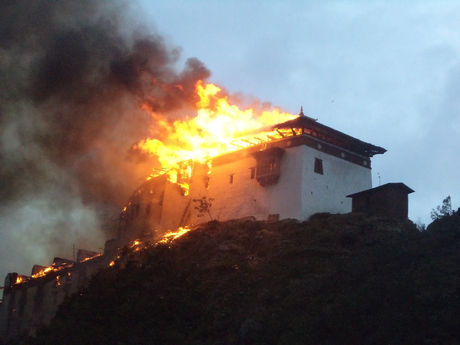
Historic Wangduephodrang Dzong destroyed by fire 2012 (Photo credit: Indra Acharja)
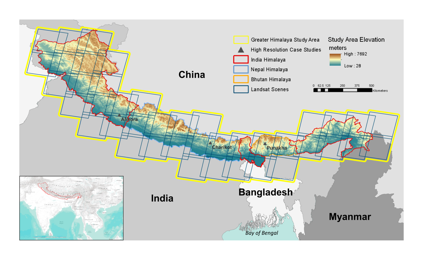
One Study Area: Two Spatial Extents
The project will be undertaken at two spatial extents. A 30 m resolution change analysis will be conducted for the entire Landsat TM archive covering an area of approximately 1.289 million km2. This wall-to-wall approach using the entire Landsat archive is a marked departure from most other urban studies in the region that focus solely on a few capital or large cities and their immediate surroundings.
To examine the accuracy of the Landsat analysis, we will use 2.5m resolution imagery for three towns: Almora, India, Charikot, Nepal, and Punakha, Bhutan. In addition to using high resolution imagery for these towns, we will carry out detailed fieldwork in these sites to collect data on health conditions, economic conditions, and political conditions to support the socioeconomic analysis. These towns were selected because of their small population size, their relative remoteness from major cities, and their geographic location. Additionally, they have each experienced different types of urban development associated with tourism, religious pilgrimages, trade and commerce, and are ideal for assessing and comparing the ability of Landsat TM versus high resolution satellite imagery to identify urban LCLUC at fine scales.